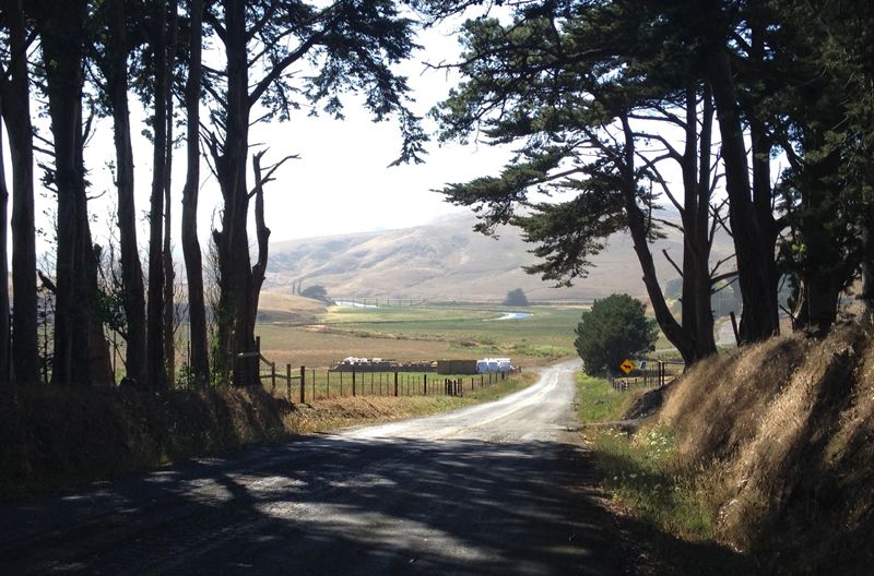
Finding a new place to ride is one of the many delights of cycling. The rolling hills and dairy pastures of northwestern Marin County and southern Sonoma offer some of the best opportunities to meander through untraveled roads, find solitude, and admire classic California landscapes.
How to Get There
From Novato to Santa Rosa, there are dozens of spots to access and ride west Marin and Sonoma. We found an easily accessible departure point off Highway 101 that avoids the higher traffic roads—the Washoe House on Stony Point Rd. To get there:
1. Take the Old Redwood Highway / Penngrove (476) exit on 101.
2. At the light turn left and crossover the freeway.
3. Turn right on Stony Point Rd. and proceed five miles to Roblar Rd. (with the Washoe House on the corner).
4. The west side of Stony Pt. offers the best parking options.
What You're In For
About 35 miles and 1,700 feet of climbing on a decidedly rural ride that belies its proximity to suburbia. There are a couple of fast paceling opportunities for groups and plenty of route options for extending your time in the saddle.
The Ride Route
1. As you pedal west on Roblar Rd. it gets progressively more rural. It's six and quarter miles to Valley Ford Rd., and you'll enjoy a nice wide shoulder.
2. Turn left and you may get a good push from afternoon winds on this stretch.
3. Roll down to the western edge of the Two-Rock Valley, and at 10.3 miles turn right on the Fallon-Two Rock Rd. It won't take you long to realize this section of the road is less traveled—surface is a bit bumpy from years of patches atop patches—but hang in there, it improves as we cross into Marin County. NOTE: You may hear gunfire as you approach Alexander Rd. Relax, you're not the target. It's only the shooting range across the valley.
4. After a few rollers, and some tempting side roads to the right (each of which intersect with the Valley Ford Road) you begin a fast descent down to Highway 1.
5. Cross onto the Whitaker Bluff Rd. and continue into Fallon to back road territory.
6. As you reach the upper reaches of the Estero de San Antonio, the next intersection may seem a bit confusing, but bear right and then bear left (to stay on Whitaker Bluff) as you cross Middle Rd. NOTE: You may want to lay the pedal hammer aside as the scenery here is quite enchanting, but in either case the 6% grade will slow your pace as you climb higher on the bluff and overlooking the expanding Estero.
7. The much steeper descent brings us to the Franklin School-Valley Ford Rd. where we'll make a right (a left would take us out to Dillon Beach).
8. Soon you'll hit the steepest climb of the day, with a few long moments spent in double digit gradients (fixed gear bikes are not recommended). The reward is an exhilarating downhill into Valley Ford.
9. At the stop sign, turn right onto Highway 1.
10. After exiting Valley Ford, there is little to no shoulder, so be alert and ride single file for the next three miles.
11. At this point Highway 1 leaves you with a right turn, and you'll gain a wide shoulder and pick-up speed as you head back on Valley Ford Petaluma Rd.
12. At 27.8 miles you meet up again with Roblar Rd. where a careful left turn begins your return to the start on Stony Point.
Refueling Sites
At the mid-ride point on the first cross of Highway 1, go left down the Highway to Tomales—there's a killer bakery there, very popular with cyclists. You can rejoin the route by going west on Dillon Beach rd, (across from the bakery) then turn right after a mile or so on Middle Rd. to join the Whitaker Bluff Rd.
Valley Ford has a market and an old school family style Italian restaurant, Dinucci's. The Washoe House, 150 years old and counting, is open for lunch and dinner. Downtown Petaluma, fifteen minutes away, offers the entire spectrum of dining experiences.
Related Articles
