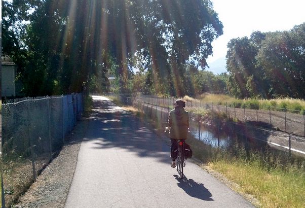
The East Bay’s Iron Horse Trail is one of the premier cycling routes in the state, providing the residents of Concord and the San Ramon Valley varied recreational (and transportation) opportunities. The former railroad righ-of-way was abandoned by Southern Pacific in 1977 and when fully completed the regional trail will pass through two counties and 12 cities in its 55-mile trek from Livermore in Alameda County to Suisun Bay in Contra Costa County
This ride takes in the northern portion, a 15 mile section that extends from Highway 4 in Concord down to Sycamore Valley Road in Danville.
How to Get There
1. Start at the northern terminus of the trail, on Marsh Road, at the east end of the bridge over Walnut Creek. There is parking available on Marsh, west of the bridge at the end of the runway of Buchanan Airfield.
2. For a southern start point, the Danville Park & Ride offers a great jump off point. It’s located just off Highway 680 on the Sycamore Valley Rd. and it's also a stop on the County Connection’s bus route 21 that runs from Bart Walnut Creek to San Ramon Transit Center.
3. A third option is to start in the middle from the Pleasanton BART Station, just steps away from the Iron Horse
What You’ll Experience
Great valley views of the surrounding hills and Mt. Diablo, quiet back streets of suburbia, an opportunity to ride at a relaxed pace without automobile traffic, and many places to stop, rest, and refuel. A highlight is crossing over the Ygnacio Valley Rd. in Walnut Creek on the Robert I Schroder Bridge, a visual tour-de-force. The 30 miles in and out aren’t too taxing; you’ll climb less than 200 feet each direction (another great feature of a converted rail bed: easy gradients).
Be Prepared
1. Wear sunscreen.
2. Bring water
3. Carry a spare tube and pump, the surface is a bit rough in the Walnut Creek section.
4. Have a cell phone and cab fare as a backup plan.
More information about the Iron Horse trail can be found on the East Bay Regional Parks District website.
Related Articles
