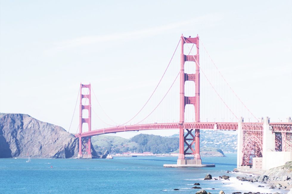
Lace up your sneakers to take in the many sights (and snacks!) along the way.
When the urge strikes to stretch our legs, we need not even leave the city to get a good, heart-pumping hike on—more than 30 miles of trails wind throughout the city. Our favorite? The route from Ocean Beach to Land's End and along the coast to the Presidio. The views from this trail will keep you breathless, ranging from rugged beach to the old Sutro Baths, to hills alive with wildflowers and twisted cypress trees, and even some great neighborhoods. Get going.
GETTING STARTED
Take the N train to Judah & 46th, where you can get a quick jumpstart with coffee and that famous cinnamon toast at Trouble Coffee & Coconut Club (4033 Judah St.).
Or, if protein is what you crave, you can't go wrong with scrambled eggs and hashcakes at Beachside Cafe (4300 Judah St.).
THE HIKE
Walk the three blocks and cross over the Great Highway to find yourself amid the dunes of Ocean Beach. Head north toward Cliff House, and watch the surfers braving freezing waters while others chill on the sand.
(Cliffhouse; photo via Westside Observer)
Take a pause at Cliff House (1090 Point Lobos Ave.) to get caught up on the landmark's turbulent history. Don't miss the Camera Obscura, a one-of-a-kind giant camera based on a 15th Century Da Vinci design.
Mosey on to Land's End and the Sutro Baths (here's a map), the beautiful ruins that we wish were still in tact! This is a gorgeous spot for a photo opp nonetheless, and makes us wonder what life must have been like in old San Francisco. Stop at the visitors center for a lesson in yesteryear.
Continue following the coastal trail along the cliffs (here's a map!), where jaw-dropping vistas promise a steady flow of hikers and runners. Peek through the trees to spot the old Cliff House Railroad, and, on a low tide days, numerous shipwrecks that hint of the rough seas below.
Take a breather (and an obligatory selfie) at the Eastern Coastal Trail Overlook (map), where you'll get your first look at the Golden Gate Bridge in all its glory. Then, keep following the Coastal Trail and veer north to the Eagle Point Labyrinth (map). Hidden a bit off the beaten path, the labyrinth was built in 2004 by local artist Eduardo Aguilera to enhance the "meditative, circuitous paths for peace, love and enlightenment". Art plus nature: we dig it.
Once you're back on the Coastal Trail, you'll pass through diverse plant life and past trails that branch off to Lincoln Park Golf Course and the Legion of Honor. The Land's End Trail will end at 32nd Avenue and El Camino Del Mar.
(Photo via San Francisco Days)
Continuing on El Camino Del Mar, here you'll enter into a totally different terrain: The neighborhood of Sea Cliff, known for posh maisons, celebrity sightings, perfectly pruned gardens, and ocean views. Stay left on El Camino del Mar to continue onto Sea Cliff Avenue. If you turn left on 25th Avenue and keep right, you will see a small passage to Baker Beach.
Famous for being the original site of Burning Man, today's Baker Beach (map) is beloved for picnicking, bonfires, and naked sunbathing. While not so great for swimming, this stretch of coast is well suited to games like frisbee, volleyball, and fishing. Adventurers take heed: If you climb over to rocks on the north end, beware the tide!
Climb the notorious Sand Ladder to Lincoln Blvd. to begin the Battery to Bluffs Trail on the left, which exposes stunning views of Sea Cliff, the Marin Headlands, and Baker Beach. You will pass by the Battery Crosby: Originally built in 1900 to protect water minefields, it's more often used as a playground for skaters and photographers today.
The trail here (map) is windy and steep with many stairs, but it blooms with coastal ground cover and offers some of most scenic landscapes in SF. Unfortunately, dogs are not allowed, and, on rainy days, paths may be closed due to rock slide.

Despite its size, the 218-year-old Presidio of San Francisco, which spans almost two-and-a-half square miles, is among the city's most charming neighborhoods (never mind that it's actually a national park). Here, quaint old military homes rest inside the dense forest, which is also home to a National Cemetery, the Presidio Lawn, the Walt Disney Museum, and a few really great restaurants. (Check out our ultimate guide to the Presidio, here.)
THE FINISH LINE
When you finally arrive at the Presidio Main Post Lawn, take off your shoes, cop a squat on the lawn, and give yourself a pat on the back for conquering a seriously major urban hike. Once you've caught your breath, it's time to indulge—after all, you deserve it. Chef/goddess Traci Des Jardins has recently opened three restaurants here: The latest, Transit Cafe(215 Lincoln Blvd.), is an indoor/outdoor must for easy grub, including breakfast burritos, salads, burgers and Neapolitan pies to eat in or take to go.

Just a few feet away, the 43 and 28 busses will take you back home.
THE QUICK FACTS
Hike Duration: Approx. 2 hours and 30 minutes
Difficulty: Easy to moderate
Weather: Mostly sunny, but hey, this is San Francisco: Be prepared for fog and wind. That means layers to all you visitors out there. We recommend bringing a light jacket, sunscreen, and a water bottle. Hiking shoes are not necessary.
FYI: This hike is only partly accessible to strollers and wheelchairs.
For more information on what to do in the Presidio, check out our handy neighborhood guide, here:


